Environment & Wildlife
Estates of Credit Ridge sits along the Credit River valley in west Brampton. This guide covers the watershed the neighbourhood drains to, the valley lands Credit Valley Conservation regulates nearby, the City's local tree-planting record, and what the public record shows about wildlife in the area.
Estates of Credit Ridge sits along the Credit River valley in west Brampton, with several streets backing directly onto green areas, ravine lots, or the Wolf Country Valley pond system. That setting comes with a bigger picture: a watershed managed by Credit Valley Conservation, valley lands with their own development rules, City tree-planting programs, and the wildlife that comes with living next to a river corridor in the GTA.
This page pulls together what is publicly documented about the environment around Estates of Credit Ridge: the watershed the neighbourhood drains to, which streets sit near a Credit Valley Conservation regulated area, how the City tracks tree planting locally, and what the public record shows about coyote activity in the area, year by year.
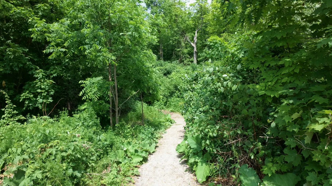
Estates of Credit Ridge has a lot of woods and nature for a city neighbourhood. It is not uncommon to see a coyote, or to hear coyotes howling at night. I have personally seen turtles here, along with all the birds and other animals you would expect. I have hiked Wolf Country Valley and walked the trails, and it really is a diverse, nice place to live.
Harpreet Sandhu, Real Estate Broker
None of this is a substitute for a professional opinion on a specific property. If a purchase or renovation decision depends on exactly where a regulated boundary falls, Credit Valley Conservation and the City of Brampton are the authorities to confirm it with directly.
The Credit River Watershed & Huttonville Creek
Estates of Credit Ridge sits within the Credit River watershed, managed by Credit Valley Conservation (CVC), the conservation authority responsible for the Credit River and its tributaries from Orangeville down to Lake Ontario in Mississauga.
Within that larger watershed, Estates of Credit Ridge drains primarily to the Huttonville Creek subwatershed, one of several smaller drainage areas CVC tracks individually for water quality, flood, and natural-heritage planning. The land around the neighbourhood also sits close to the edges of a couple of neighbouring subwatersheds that CVC maps separately.
This is a watershed-level description, not a statement about drainage on any individual lot. For a specific property, Credit Valley Conservation's own mapping tools and planning staff are the authority to consult.
Subwatersheds Near Estates of Credit Ridge
- Springbrook Tributary
- Churchville Tributary
- Huttonville Creek (the neighbourhood's primary subwatershed)
- Norval to Port Credit
Learn about the Credit River watershed from Credit Valley Conservation →
Valley Lands & CVC Regulated Areas
What "regulated" means, and which neighbourhood streets are near a mapped regulated area.
Credit Valley Conservation regulates development, site alteration, and interference with wetlands near valley lands, floodplains, and watercourses under Ontario's Conservation Authorities Act. In practice, that means a property owner usually needs a CVC permit before building, grading, or placing fill near a regulated valley, stream, or wetland, even on land they already own.
"Regulated" is a planning and permitting term. It does not mean a property has flooded, will flood, or is unsafe. It means that specific kinds of work near that land need a CVC permit, and that the rules are different from a standard municipal building permit.
CVC publishes the boundary of its regulated area as open data. Comparing that published boundary against the street network shows which Estates of Credit Ridge streets have a right-of-way that comes near or crosses a mapped regulated area. That is a street-level, informational comparison only.
This page's street list is not a CVC determination for any property. Regulated-area boundaries can be refined, and a specific lot's status can only be confirmed by Credit Valley Conservation directly. If a purchase, sale, or renovation depends on where a regulated boundary falls, contact CVC's planning and permits team before relying on this page.
Neighbourhood Streets Near a Regulated Area
Based on the City of Brampton's street network intersected with CVC's Generic Regulations Limit (2025):
- Accolade Court
- Adamsville Road
- Airlie Court
- Astrantia Way
- Beachville Circle
- Beacon Hill Drive
- Cachet Court
- Cannington Crescent
- Creditview Road
- Elbern Markell Drive
- Fallowfield Road
- Ingleborough Drive
- Louisburg Crescent
- Makeena Street
- Maybeck Drive
- Merrittonia Street
- Montreal Street
- Pathway Drive
- Royal West Drive
See CVC's own regulation mapping tool →
CVC planning & permits: how it works →
Ponds & Green Areas
Several streets in the neighbourhood back onto a pond, a ravine lot, or a green area rather than directly onto a CVC-regulated valley. Wolf Country Valley, with its pond and gravel trail, is one of these, but it is not the only one; City of Brampton open data names several ponds and green spaces within and around the neighbourhood.
This page deliberately does not duplicate that street-by-street pond detail. See the dedicated guides for the full picture:
Parks & Trails
The Credit River trail system, named parks, and conservation lands around the neighbourhood.
View Parks & Trails →Wolf Country Valley
Park guide, access, and character.
View Park Guide →Luongo Park
Park guide, access, and character.
View Park Guide →Maxwell & Lois Rice Park
Park guide, access, and character.
View Park Guide →Urban Tree Canopy & Planting
The City of Brampton tracks community tree-planting activity, including plantings organized with residents, community groups, and partner organizations, through its open-data Tree Planting Tracker. Within and around Estates of Credit Ridge, that tracker records 345 trees planted across 20 recorded planting events.
This is a record of organized plantings the City has logged in this specific area, not a full canopy survey; it does not capture every tree on private property or every planting outside the tracked program.
Credit Valley Conservation tree planting programs → · CVC neighbourhood tree giveaway →
Trees Planted by Year
Wildlife
Living next to a river valley means sharing it with the wildlife that uses the corridor.
A river valley like the Credit River corridor functions as a wildlife corridor through an otherwise built-up part of Brampton. Deer, foxes, birds of prey, and coyotes are all documented using valley and ravine habitat in this part of the GTA, and coyotes in particular are common across most of urban Brampton, not unique to any one neighbourhood.
The City of Brampton's Animal Services team publishes coyote sighting reports as open data. In the area around Estates of Credit Ridge, that public record shows the following sighting counts by year:
Coyote sightings are reported by the public and reflect sightings, not a population count or a measure of danger. Coyotes are a normal part of the Brampton landscape; coexistence, not elimination, is the City's and CVC's standard guidance.
City of Brampton: living with coyotes → · CVC: nature & wildlife →
Coyote Sightings by Year
Sighting reports only, within the area around Estates of Credit Ridge. Not a precise neighbourhood boundary and not individual locations.
How to Get Involved
Programs run by Credit Valley Conservation and the City of Brampton.
CVC Volunteer Programs
Tree planting events, stewardship days, and other hands-on ways to help care for the Credit River watershed.
Neighbourhood Tree Giveaway
CVC's program for residents to request native trees and shrubs for planting on their own property.
City of Brampton Environment
The City's environment programs, including tree planting, naturalization, and sustainability initiatives.
Contains information licensed under the Credit Valley Conservation Open Data Licence v1.0 and the City of Brampton Open Data Licence (CC BY 4.0). Mapping shown here is for general information only and is not an official determination by Credit Valley Conservation or the City of Brampton.
Sources: CVC Generic Regulations Limit 2025 · CVC Subwatersheds 2018 · City of Brampton Tree Planting Tracker · City of Brampton Animal Services coyote sightings
Data snapshot generated Oct 14, 2026, 5:20 pm.
Have a Question About a Specific Street or Lot?
Whether a home backs onto green space, sits near a regulated valley, or you simply want the full picture before buying, I can walk you through what the public data does and does not tell you.